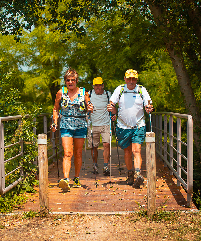
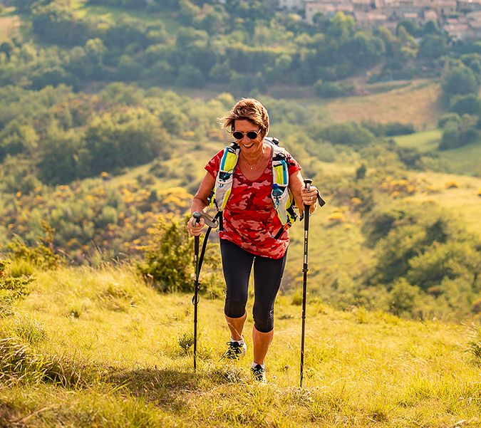
Home » Nature » Main Itineraries

Main Itineraries

photo_gr7_01
photo_gr7_02
photo_gr7_03

GR7

From the Vosges to the Pyrénées, the GR® 7 (Long Distance Hiking Trail) roughly follows the watershed. On the one hand, rivers converge towards the Mediterranean Sea, on the other towards the Atlantic Ocean. Throughout this hiking trail, the route evolves through iconic landscapes and sites, and gives pride of place to ridge lines, hills and ancient massifs, ranging from panoramas to viewpoints – all remarkable!

USEFUL INFORMATION

ACCESS TRAIN STATION

Access from the train station (Gare SNCF) in Castelnaudary – make your way to the Grand Bassin and follow the Canal du Midi in the direction of Pexiora.

www.sncf.com
www.ter.sncf.com/occitanie

TRANSPORTS RÉGIONAUX LIO

To get to Fanjeaux from Carcassonne or Castelnaudary

Transports régionaux lio (regional transport)

Castelnaudary – Villasavary – Fanjeaux: line 411

Carcassonne – Montréal – Prouille – Fanjeaux: line 405

https://lio.laregion.fr

TOPO-GUIDES

Topo-guides and useful information :

FFRandonnée Aude : +33 (0)4 68 47 69 26

www.auderando.fr

ACCOMMODATION

Villepinte, Villasavary, Fanjeaux, Fenouillet du Razès, Hounoux…

See the Cœur des Collines Cathares (in the Heart of the Cathar Hills) accommodation page

THE TOUR DU LAURAGAIS

The Tour du Lauragais (circuit of the Lauragais) includes several stages of a 124-km journey with its variants. From village to village, you’ll encounter castles, bell-gables, weigh houses and half-timbered façades that are worth a visit. But above all, we discover an extraordinary diversity of landscapes ranging from the foothills of the Montagne Noire to the hills of the Piège , and including the Lauragais furrow, alternating ridge lines and valley floors. We rediscover the happiness of slow rhythms, the pleasure of observing the gentle hills where the bright yellows of sunflower fields rival green meadows mixed with woods. We pass through medieval villages bathed in light where the monuments bear witness to an eventful history. To be done on foot, horseback or on mountain bikes, in stages.

La_tour_de_lauragais_01
La_tour_de_lauragais_02
La_tour_de_lauragais_03
La_tour_de_lauragais_04
STAGE 1 : MONTMAUR – LA POMAREDE : 15 KM

Along the walk, some curiosities need to be observed, for example the castles of Montmaur, Saint Paulet or La Pomarède which houses a hotel-restaurant, or the remains of the Abbey of Notre-Dame des Anges ( 14th century).

STAGE 2 : LA POMAREDE – VERDUN-EN-LAURAGAIS : 20KM

During this stage, you will cross Issel where some remnants of the village fortifications remain to be seen , then you will cross the hermitage of Saint Papoul (By the GR7, possibility to join the village of Saint Papoul and its abbey). In the end, in Verdun en Lauragais, the Domaine de Rhodes is the former residence of the painter Paul Sibra, who left many painted canvases on the Lauragais countryside.

STAGE 3 : VERDUN-EN-LAURAGAIS – VILLASAVARY : 30 KM

On your way, you will pass through the villages of Villespy, Villepinte and Villasavary. In Villespy, you will find an old fortified gate dating from the 15th and 17th centuries, and in Villepinte, the parish church (12th – 15th centuries). In Villasavary, you will reach the site of Besplas, a former medieval town which, in the 19th century, became the site of a renowned farm school : the first one in France. The Romanesque chapel of Saint Martin de la Salle, known as Besplas, hosts some information and cultural boards which tells you the story of that place.

For more information: www.visitevirtuelle.villasavary.com

STAGE 4 : VILLASAVARY – GAJA LA SELVE : 21 KM

From Besplas hill, you will cross fields and valleys, to Laurac, the old medieval seigneury which gave its name to Lauragais country. The perched village, which retains the remains of a fortified gate (the Porte Saliège – 13th century), keep all of its old charm as well as numerous viewpoints over the Lauragais furrow. To reach Gaja la Selve, you will pass through Génerville (which houses a charming little Romanesque chapel known as “Arbonens”), Pécharic et le Py (site of a former hospital commandery now private property) and Plaigne. The church and its steeple-wall are there just as remarkable as the castle of the Commandery (of the Order of Malta) which now hosts lodging and various events (group visits also possible, on request – 15 to 20 people , 6 € / pers,

Tel: + 33 6 40 60 50 74, info@chateau-la-commanderie.com).

Also in Plaigne, the Renaissance castle of Blazens (private).

STAGE 5 : GAJA LA SELVE – LA LOUVIERE LAURAGAIS : 18,5 KM

Departing from Gaja la Selve, you will follow the woods of La Selve, where many Faydits and Cathars knights, after the beginnings of the crusade against the Albigensians, made a stop where they stayed to be forgotten. To observe from your path, the castles of Saint Sauveur and Puget. Finally, in La Louvière, to see also, the castle of the 17th century, remodeled in the 19th and 20th centuries.

STAGE 6 : LA LOUVIERE LAURAGAIS – BELFLOU : 19,5 KM

On your journey, the castles of Marquein (16th century), Fajac la Relenque (16th century) and Belflou (15th century), the dovecote of Saint Michel de Lanès… On your arrival in Belflou, superb views on the lake of La Ganguise.

STAGE 7 : BELFLOU – MONTMAUR : 20 KM

Starting from Belflou, follow the banks of the lake Ganguise before reaching Labastide d´Anjou then the drain, linked to the creation of the Canal du Midi. The stream was responsible for bringing water from the Saint Ferréol basin to the Naurouze weir. From a distance you will observe the castle of Airoux (16th-17th centuries).

USEFUL INFORMATION

MAPS AND USEFUL INFORMATION

Maps and useful information are available at the Au Cœur des Collines Cathares Tourist Office

Tel : +33 (0)4 68 24 75 45

collines_du_vent_01
collines_du_vent_02
collines_du_vent_03
collines_du_vent_04
collines_du_vent_05

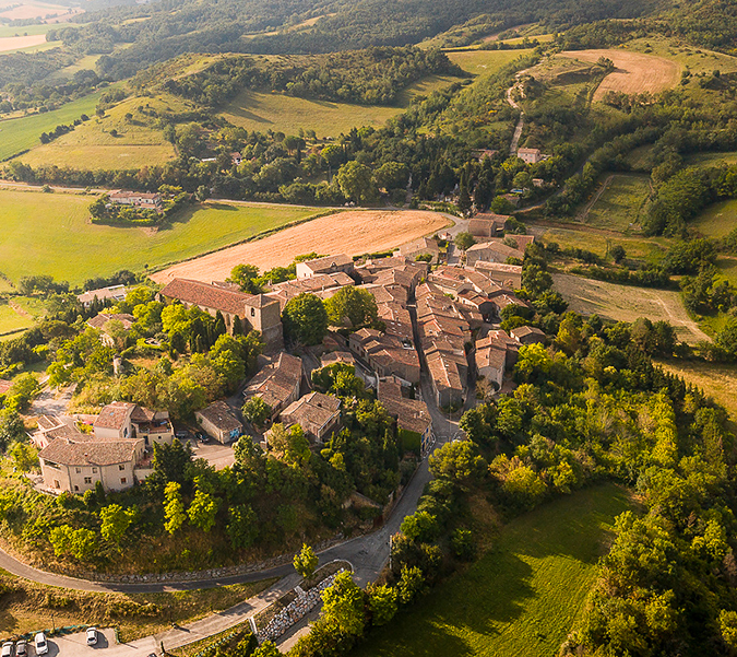
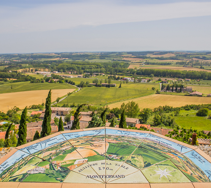
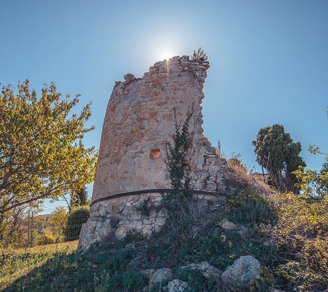
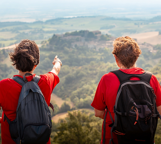
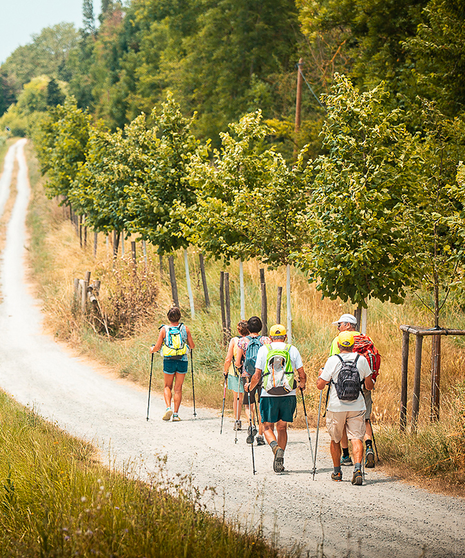
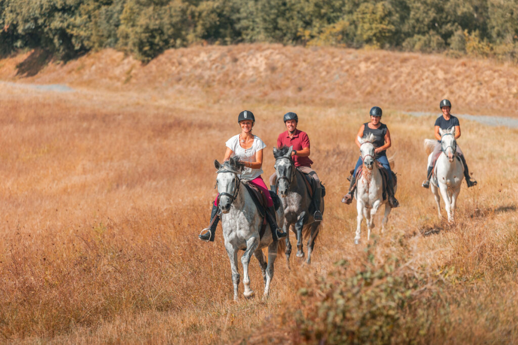
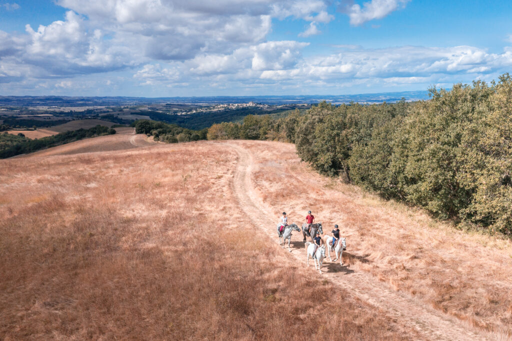
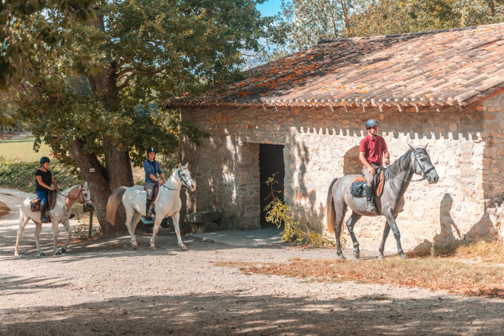
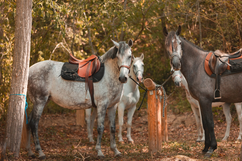
THE COLLINES DU VENT

In the footsteps of the former millers, follow the Canal du Midi and then go up to the ridges of the Lauragais. Soak up the panoramas of the Pyrenees Mountains, the Montagne Noire (Black Mountain) and theperched villages of the ‘Collines du Vent’ or ‘Windy Hills’. The mills run from Avignonet to Fanjeaux and accompany you on this 50-kilometre route. The 48-km Avignon-Fanjeaux link can be done on foot, a mountain bike or horseback. It is achievable during the day for trained mountain bikers, the route can be divided into two or three stages by hikers and horseback riders. Remember to book your accommodation in your stopover villages.

STAGE 1 : AVIGNONET-LAURAGAIS- SEUIL DE NAUROUZE : 4 KM

This commune located in Haute-Garonne in Pays Lauragais has experienced economic growth since Antiquity thanks to the wheat trade. The cultivation of the woad plants in the 15th century and cereals, transported on the Canal du Midi from 1681 and later by train, were to be the economic engines of the prosperity of the Lauragais region over the centuries. Witnesses to history, the remains of the ramparts, the fortified castle and its tower punctuate a visit to the village.


Do not miss: the night markets and the summer festival and the autumn fair in October. 2 km along the towpath in the direction of Baraigne, you’ll find Port-Lauragais. At the confluence of the Canal du Midi and the Deux-Mers canal, this “village area” offers, in addition to a regional products shop, a beautiful exhibition on the Canal du Midi.

STAGE 2 : SEUIL DE NAUROUZE – MONTFERRAND : 3,3 KM

Perched on its rocky outcrop, the village has been a point of communication between the Mediterranean and Atlantic basins since the Gallo-Roman period. Placed on the Via Aquitania it served as a point

control for the passage of goods and travelers. In 1670, Pierre-Paul Riquet had the Rigole de la Plaine dug in Naurouze, to collect water from the Montagne Noire and feed the two sides of the Canal du Midi. On this reach, do not miss the Peyre Clouque site, which houses thermal baths remains, two early Christian churches and a necropolis. The former aeronautical lighthouse, built in 1927, guided the first Aéropostale planes at night.

STAGE 3 : MONTFERRAND – BARAIGNE : 3 KM

In a calm hilly landscape, Baraigne is a village in the Trap on the edge of the Aude and Haute Garonne departments. Built around its Romanesque church, the village was one of the first in Lauragais convinced for Catharism in the 12th century. Today it is mainly the nearby Ganguise dam that will attract your attention. Created in 1983, this 500-hectare body of water initially designed for agricultural irrigation has become a strong point for water sports in Lauragais.

A Lauragais enigma: as in the neighboring towns, around ten discoidal stelae can be discovered in the village, in the church and its cemetery.

STAGE 4 : BARAIGNE – MAS SAINTES-PUELLES : 6,2 KM

The village is located on the dividing line between the Atlantic and the Mediterranean. From the top of the village, you can admire the plateau line where the Canal du Midi feeder channel and the Naurouze are winding. According to tradition, the Puelles are these young women who collected the martyred body of Saturnin, the first bishop of Toulouse, to give him a Christian burial.

In the land of mills, the Mas had up to 17 pastel mills in the 16th century. The last ones were in operation until the 1940s.

A family affair: The village has a very old tradition of potters. Visit the Pottery Not, which notably produces the famous cassole!

STAGE 5 : MAS-SAINTES-PUELLES – VILLENEUVE LA COMPTAL : 7 KM

The name of the locality could suggest the existence of a Bastide des Comtes de Toulouse, however, no information comes to support this supposition. Since the Middle Ages, Villeneuve la Comptal has crossed, like the nearby villages, the various adventures of Lauragais. The first half of the 16th century was a particularly prosperous moment with the pastel cultivation. The second half accumulated ruins and destructions here with the religious wars. Originally grouped around the castle and the fortified church, the village prospered in particular thanks to its four windmills, actives from the sixteenth century to 1908.

Take to the skies: When you arrive, discover the orientation table dedicated to Clément ADER who took off in 1873 his first glider with straps, “the feather bird” from these hills.

STAGE 6 : VILLENEUVE LA COMPTAL – FENDEILLE : 3,6 KM

In the 13th century during the Crusade against the Albigenses, the fortified town of Fendeille was given by Simon de Montfort (leader of the Crusaders) to one of his lieutenants, the Chevalier de Fontaines. From the “Pech Haut” (326 m) and its panorama over the plain, the “Collines du vent” trail runs along the perimeter wall of the large park of the Château de Fendeille. The castle is now communal property and houses the village school.

An Occitan poetry in Lauragais: Fendeille was the birthplace of Prosper Estieu, born in 1860. This “Felibre Majoral” paid homage with his verses to all the Lauragais. As pioneer of the Occitan movement, he created the magazine “Lo gai Saber” after the 14-18 war. A board indicates his birthplace in the village.

STAGE 7 : FENDEILLE – MIREVAL LAURAGAIS : 3 KM

The overall layout of Mireval-Lauragais has changed little since the Middle Ages. The Chemin de Ronde goes around this ancient fortified village which has retained its two 14th century gates. Sheltered by the walls, the houses have clustered around the church, whose massive silhouette dominates the landscape.

Watch the Valley! This is the  Mireval etymology . The view on Lauragais plain and the Montagne Noire is exceptional, will you be able to recognize the villages of the Collines du Vent route?

STAGE 8 : MIREVAL-LAURAGAIS – LAURABUC : 2,5 KM

The village of Laurabuc is nestled in a valley between two hills, on the first relief line of the Piège. If the first footsteps of human occupation are dated from the Bronze Age, the Middle Ages and then the religious wars in the 16th century strongly marked the village.

A slice of history: the Calvary of Laurabuc was built in the 19th century following the wish of the village priest, Abbé Bize. He had taken an oath to build an ordeal if the village was spared by the cholera epidemic which affected the region around 1835. Today an association is preserving the site.

STAGE 9 : LAURABUC – LAURAC-LE-GRAND : 6 KM

This ancient castrum, perched at an altitude of 400m, was once one of the main medieval lordships in the region and gave its name to the Lauragais country. A major center of Catharism in the 13th century, the influence of the Lords of Laurac in the region is due to the charisma and wealth of Aymeric de Laurac and his mother, Blanche, who very early converted to Catharism.

A Cathar stronghold: The Collines du Vent path crosses, at the level of the Pierre Plantée, an interpretive trail which invites the walker to discover a Cathar history, the one of the village and its lords.

STAGE 10 : LAURAC-LE-GRAND : VILLASAVARY : 7,8 KM

Villasavary is an ancient fortified village from the 12th century. It has a rich vernacular heritage to be discovered in situ and thanks to a digital application (the press, the 18th century mill, the old halls, Saint-Pierre church, etc.). Not far from the village, the Besplas hill, a former fortified town founded in the 12th century by the lords of Laurac, takes place at the top of a hill that is now wooded and houses with a small Romanesque chapel. The Besplas chapel, dedicated to Saint Martin de la Salle, is listed in the supplementary inventory of historical monuments. The territory of Besplas was attached to the Municipality of Villasavary during the Revolution.

The first farm school in France: On the Besplas hill, the former agricultural estate became in 1847 the first farm school in France. This highly regarded school operated until 1892.

STAGE 11 : VILLASAVARY – FANJEAUX : 5 KM

Overlooking the plain, perched on a rocky outcrop, the Fanjeaux spire stands out on the horizon. This castrum has been, since Gallo-Roman times, an important crossroads of communication between the Pyrenees, the Montagne Noire and the Lauragais plain. Rich in its historical past, Fanjeaux was in the Middle Ages, a Mecca of Catharism in Languedoc. After the establishment of the bishop of Toulouse, Guilhabert de Castres, a great figure of Catharism, the locality had seen the installation of canon Dominique de Guzman who chosed Fanjeaux as a starting point of the Catholic reconquest against the Cathar heresy . Dominic founded a first community here before the Order of the Dominicans in the Monastery of Prouilhe, considered today as cradle of the Order. Inside the village, there are many heritage items, monuments and buildings that bear witness to its history.

Art in the service of History: Loïc Tellier offers us a look at the past through ten sculptures, ten scenes from the historic Fanjeaux installed in the village. The power of metal in the face of the poetry of history, offers a journey to discover with your family thanks to a digital application or an audio guide rented from the Intercommunal Tourist Office, Place du Treil.

USEFUL INFORMATION

RECOMMANDATIONS

  • Make sure you wear good walking shoes.
  • Use sun protection and bring water with you.
  • Do not light a fire.
  • Respect the fauna and flora.
  • Keep your rubbish until the next dustbin, leave nothing behind you.
  • Keep dogs on a leash.
  • Close the fences and the gates for livestock after you.
  • Always follow the markings.

MAPS AND USEFUL INFORMATION

Maps and useful information are available at the Au Cœur des Collines Cathares Office de Tourisme

Tel : +33 (0)4 68 24 75 45

Visit the website of the National Federation of Hunters (Fédération Nationale des Chasseurs) www.chasseurdefrance.com/chasser-en-france/dates-douverture/